Geographic Information Systems (GIS) have evolved from simple mapping software into powerful engines for data-driven decision-making. Organizations that depend on spatial data, whether for land development, environmental planning, or logistics, rely on robust analysis in GIS to uncover trends and patterns hidden in complex datasets. For many firms, engaging with GIS Services Company Solutions early in their projects ensures that insights are actionable rather than just visual.
This guide explores the key methods of analysis in GIS, demonstrating how they apply to real-world scenarios and providing practical examples to help both professionals and students.
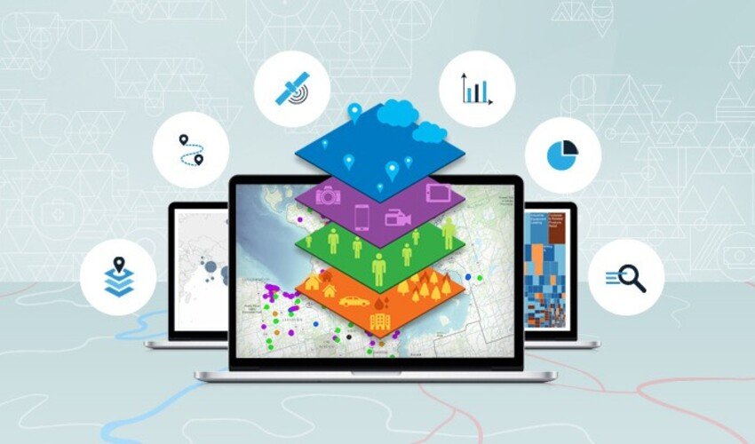
Key Takeaways from Analysis in GIS
- Bridges spatial and non-spatial data: Analysis in GIS integrates geographic features with demographic, environmental, or economic datasets to generate actionable insights for smarter planning and decision-making.
- Multiple core methods at work: Techniques such as spatial overlay, network analysis, spatial statistics, and raster analysis form the foundation of GIS, allowing users to examine relationships, movement, patterns, and continuous phenomena across landscapes.
- Diverse toolset available: Professionals can choose from open-source platforms like QGIS for flexibility and customization, or enterprise-grade systems such as ArcGIS Pro for advanced modeling and integration with large datasets.
- Avoiding common pitfalls is essential: Missteps like overlooking data quality, relying too heavily on visuals without statistical validation, or misinterpreting scale can lead to costly errors in planning and execution.
- Proven real-world impact: Case studies consistently demonstrate how GIS analysis strengthens decision-making in fields like transportation planning, urban development, and disaster management by identifying gaps, predicting risks, and improving resource allocation.
- Future-ready potential: Emerging methods, including AI-assisted predictive modeling and 3D spatial analysis, are expanding what’s possible in GIS, making it a critical tool for resilient infrastructure and sustainable growth.
What Is Analysis in GIS?
At its core, analysis in GIS involves processing and interpreting spatial data to answer geographic questions. Unlike simple mapping, which shows where something is, GIS analysis helps explain why it’s there, what it influences, and how it changes over time.
For example:
- Urban planners may use it to predict housing demand.
- Engineers can evaluate flood risk in infrastructure projects.
- Conservationists rely on it to track deforestation and biodiversity loss.
The strength of GIS analysis lies in its ability to combine layers of data, roads, rivers, elevation, demographics into a single system where relationships and patterns can be examined.
Core Methods of GIS Analysis
- Spatial Overlay Analysis
Overlay analysis stacks multiple map layers to identify relationships. For example, a land developer may overlay soil types with zoning maps to decide where construction is most feasible.
Applications:
- Identifying suitable land for agriculture.
- Mapping environmental hazards against population density.
- Buffer and Proximity Analysis
Buffering creates zones around a feature, such as a 500-meter radius around a school to analyze potential noise exposure. Proximity analysis measures how close features are to each other, critical in urban design and logistics.
- Network Analysis
Network analysis examines movement along connected pathways, roads, pipelines, or waterways. It answers questions like:
- What’s the shortest delivery route?
- Which roads are most vulnerable during rush hour?
This is essential in transportation planning and supply chain management.
- Spatial Statistics
Spatial statistics identify clusters, outliers, and patterns. For instance, public health agencies use it to map disease outbreaks and detect hotspots.
Key tools include:
- Moran’s I (measuring spatial autocorrelation).
- Kernel density estimation (highlighting concentration zones).
- Raster Analysis
Raster analysis works with grid data (e.g., satellite imagery, elevation models). Each cell contains a value, allowing continuous phenomena such as temperature or rainfall to be modeled.
Example: Using raster data, engineers can simulate flood plains by combining rainfall and elevation.
- 3D Surface and Terrain Analysis
Topographic modeling in 3D provides realistic insights into slope, aspect, and elevation. Infrastructure projects depend on this to minimize construction risks.
- Predictive Modeling
By integrating historical data with machine learning, GIS supports predictive analysis. For example, predicting future urban sprawl based on current land use trends.
Practical Examples of GIS Analysis
- Transportation Engineering
Cities often use network analysis to redesign bus routes and improve commuter efficiency. - Disaster Management
During hurricanes, overlay and raster analysis help predict flood-prone areas, allowing agencies to prepare evacuation plans. - Environmental Conservation
Spatial statistics allow conservationists to identify biodiversity hotspots, directing resources where they’re needed most.
Essential Tools for GIS Analysis
| Tool | Type | Strengths | Best For |
| ArcGIS Pro | Enterprise | Advanced spatial analysis, 3D modeling | Large organizations |
| QGIS | Open-source | Customization, plugins, accessibility | Small teams, academic projects |
| GRASS GIS | Open-source | Raster and terrain analysis | Environmental science |
| PostGIS | Database extension | Spatial queries on big datasets | Developers, data scientists |
| Google Earth Engine | Cloud-based | Satellite imagery, raster analysis | Climate studies |
Pros and Cons of GIS Analysis
Every powerful tool comes with strengths and challenges, and GIS analysis is no exception. Understanding both sides helps organizations maximize value while avoiding common pitfalls.
Pros of GIS Analysis
- Increases efficiency in planning and design
GIS enables teams to integrate multiple datasets, such as topography, zoning, and utilities, into one system. This reduces redundancy, speeds up workflows, and improves coordination across departments. - Enables evidence-based decision-making
Rather than relying on assumptions, GIS provides measurable insights. For instance, transportation planners can model traffic flows with real-time data to justify investments in new infrastructure. - Provides clear visualization of complex data
Maps, 3D models, and heatmaps allow stakeholders to grasp information at a glance. This makes it easier to present findings to decision-makers, communities, or regulatory boards. - Supports scenario modeling
GIS can simulate “what-if” scenarios, such as predicting flood zones under different rainfall conditions. This improves resilience planning and risk management.
Cons of GIS Analysis
- Requires high-quality data inputs
Inaccurate or outdated data leads to flawed results. For example, using old demographic layers may cause errors in urban development planning. - Software and training costs can be significant
Enterprise platforms like ArcGIS require licensing fees and staff training, which may challenge smaller organizations. While open-source tools help, they often demand technical expertise. - Risk of misinterpretation
GIS maps may look convincing, but without proper statistical checks, results can mislead. Analysts without domain knowledge may oversimplify complex patterns. - Dependence on technical infrastructure
Advanced analyses often require strong computing power and stable networks, which can be limiting in resource-constrained environments.
Common Mistakes to Avoid in GIS Analysis
Even experienced professionals can make errors when working with GIS. Because spatial data often looks convincing, it’s easy to overlook the deeper checks required for reliable results. Below are some of the most frequent mistakes and how to avoid them.
- Over-reliance on visuals
Maps and 3D renderings can appear authoritative, but a polished visualization doesn’t guarantee accuracy. Always back visuals with statistical analysis and documented methodology. - Ignoring metadata
Metadata explains where data came from, how it was collected, and what its limitations are. Skipping this step can lead to misinterpretations, for example, using outdated demographic data in fast-changing urban areas. - Forgetting scale
Scale influences what you see. A pattern that looks significant at a city level may vanish when analyzed at the neighborhood scale, and vice versa. Always clarify the scale of analysis to match the decision-making context. - Not validating models
Predictive models, such as flood simulations or urban growth forecasts, must be compared against real-world outcomes. Without validation, results remain theoretical and can mislead critical planning. - Data quality assumptions
It’s tempting to assume that official or open-source datasets are flawless. In practice, datasets may contain gaps, duplicates, or misaligned coordinates. Cleaning and verifying data before analysis is crucial. - Overcomplicating workflows
Adding too many layers or running overly complex models can create “analysis paralysis.” Focus on the most relevant variables, and document each step so results can be reproduced and trusted.
FAQs
- What is the main purpose of analysis in GIS?
To transform raw spatial data into insights that support informed decisions in planning, engineering, and policy-making. - Which method of analysis in GIS is most common?
Spatial overlay is widely used, but network and raster analysis are equally critical depending on the industry. - Do you need coding skills for GIS analysis?
Not always. Tools like ArcGIS and QGIS provide graphical interfaces, though coding (Python, SQL) enables advanced custom analysis. - How accurate is GIS analysis?
Accuracy depends on data quality, resolution, and methods. High-resolution satellite imagery and ground-truthing improve reliability. - What industries use GIS analysis most?
Urban planning, civil engineering, transportation, public health, and environmental management. - Can GIS analysis predict future changes?
Yes. Predictive modeling uses past trends and environmental data to forecast outcomes like urban growth or climate impacts.
The Future of Analysis in GIS
As digital transformation accelerates, analysis in GIS is no longer optional; it has become foundational for modern decision-making. Cities facing rapid growth, companies optimizing supply chains, and governments responding to environmental risks all depend on the accuracy and speed of GIS insights.
Organizations that invest in skilled teams and cutting-edge platforms are better positioned to anticipate challenges rather than simply react. For example, predictive GIS modeling can help transportation agencies plan infrastructure for 2030 traffic demands, while 3D terrain analysis supports engineers in building safer, more climate-resilient structures.
The real power comes from pairing advanced methods with reliable, high-quality data. When inputs are verified and tools are properly calibrated, spatial analysis moves beyond visualization into actionable strategy. Instead of just showing where issues exist, GIS analysis becomes a compass, guiding investment, policy, and design choices with measurable impact.
Looking ahead, expect tighter integration between GIS and AI, cloud computing, and real-time sensors. This fusion will transform how we track urban change, manage natural resources, and even predict disasters before they strike. The future belongs to organizations that not only adopt GIS but also use it as a strategic engine for innovation and resilience.

Read Dive is a leading technology blog focusing on different domains like Blockchain, AI, Chatbot, Fintech, Health Tech, Software Development and Testing. For guest blogging, please feel free to contact at readdive@gmail.com.